Baseline capture
The building or site is captured in 3D as it is today, giving the register a dated starting point.
Gold Coast · Brisbane · Northern Rivers and beyond
A 3D asset register you can walk through. Capture the building or site once, pin each asset to where it really sits, rate its condition, attach its documents, then capture again on a schedule and see what changed.
Quick answer Kybos builds a 3D asset record of a building or site: each asset is pinned where it sits in a measured model, with its condition, issues, photos and documents, and the site is captured again on a schedule to see what changed. It works beside existing asset management software.
Last updated
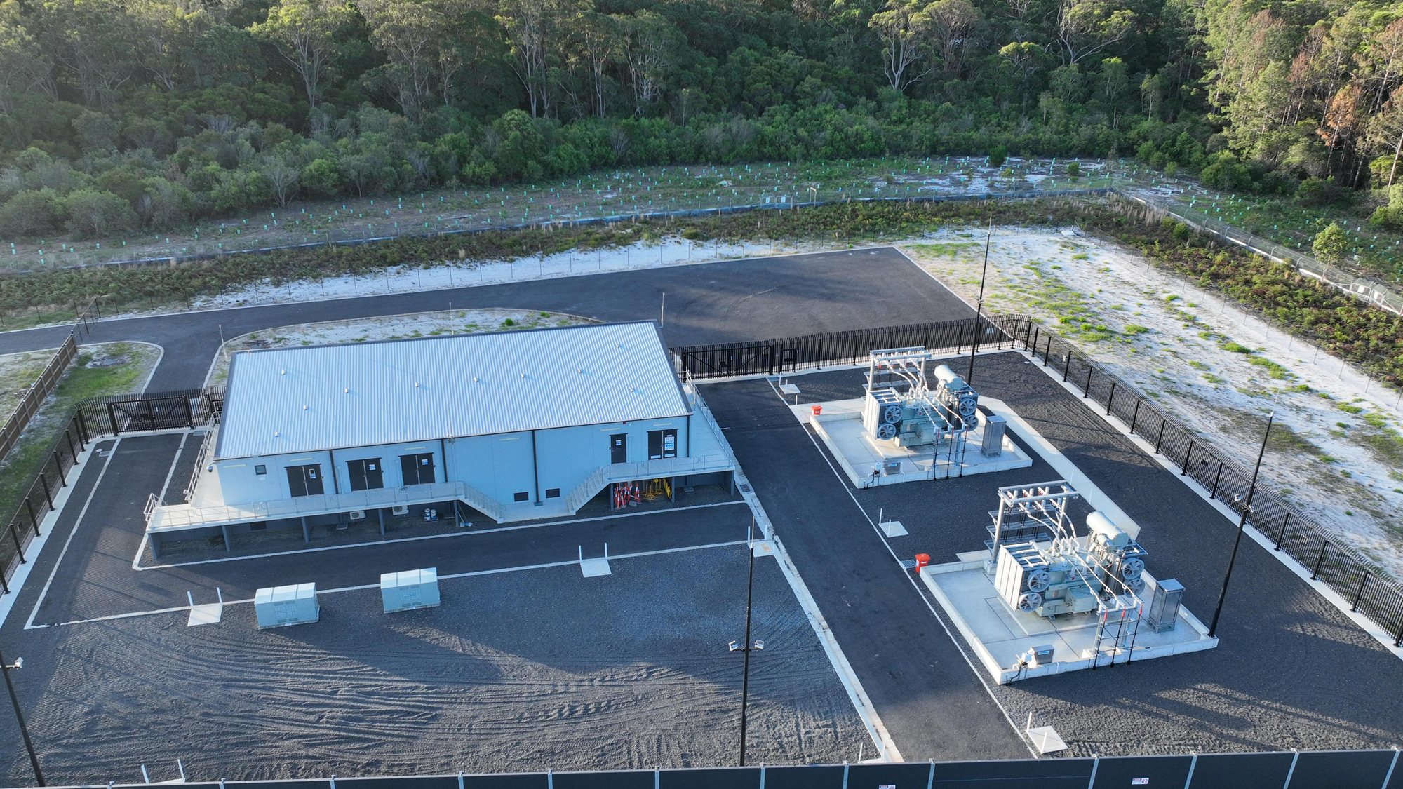
Most asset registers are spreadsheets and PDFs: a list of what is owned, with a description. They don’t show where the asset sits, what state it is in today, or how that has changed since the last inspection.
A 3D asset record closes that gap. Every asset is tied to a position in a measured 3D model of the building or site, so anyone can find it, check it and compare it, without a site visit.
The building or site is captured in 3D as it is today, giving the register a dated starting point.
Each asset (a switchboard, a pump, a play unit, a tree, a roof section) is pinned where it actually sits in the model.
Record each asset’s condition and any open issue against it, and filter the whole site by condition or status.
Return on a schedule, or after storms and major works, and compare the new capture with the last to see what changed.
Owners and facility managers keeping one record of plant, services, finishes and defects across a building or a portfolio.
Facility asset managementTrails, parks, playgrounds and green corridors held as a dated record, with the assets and issues pinned to the ground.
Open space asset managementA new building arrives with its as-built record and the documents already attached, instead of a box of PDFs.
Kybos doesn’t replace the asset management or CAFM platform you already run. It adds what those systems lack: where each asset physically is, and what it looked like on the day.
Point clouds, CAD and BIM-ready files can be delivered for the platforms that take them, and Site Atlas holds the 3D map for everyone who needs to look.
Data is encrypted in transit (TLS 1.2+) and at rest (AES 256-bit), with role-based access, password protection and private token links, on ISO 27001, ISO 27018 and SOC 2 Type II certified infrastructure.
Sensitive areas can be masked or excluded, offline delivery is available, and Kybos works under NDA for government, defence and sensitive commercial projects.
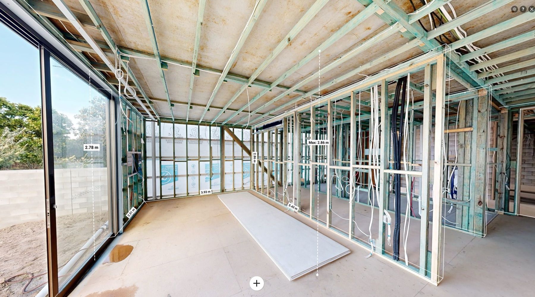
A 3D capture from a live job. Move around it, take a measurement, look at the space from an angle nobody photographed.
For estates, towers and portfolios, Site Atlas puts every building on one interactive 3D map, coloured by condition, with open issues on each one.
Site Atlas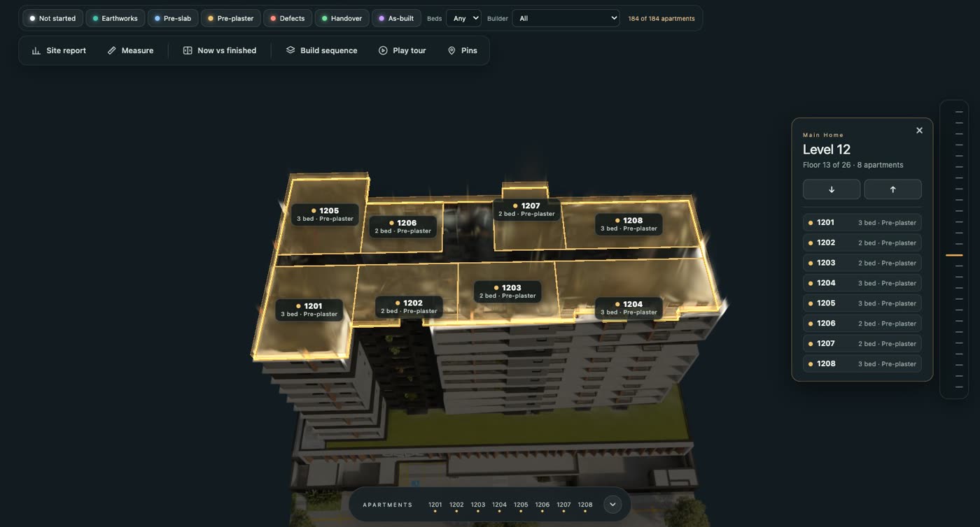
No. It works beside them. Your register keeps the financial and maintenance data; the 3D record adds where each asset is, what condition it is in and what it looked like on the day it was captured.
It depends on the asset and the risk. Many owners re-capture once a year, and again after storms or major works. A dated capture each time gives you a clear before-and-after.
Yes. Drone and ground capture cover trails, parks and public land, and the same pins, condition ratings and comparisons apply.
No. It is a dated 3D record you and your qualified inspectors work from. It doesn’t replace a licensed inspection, engineer’s assessment or registered survey.
Quote back to you within 24 hours.
Get a quote