Progress aerials
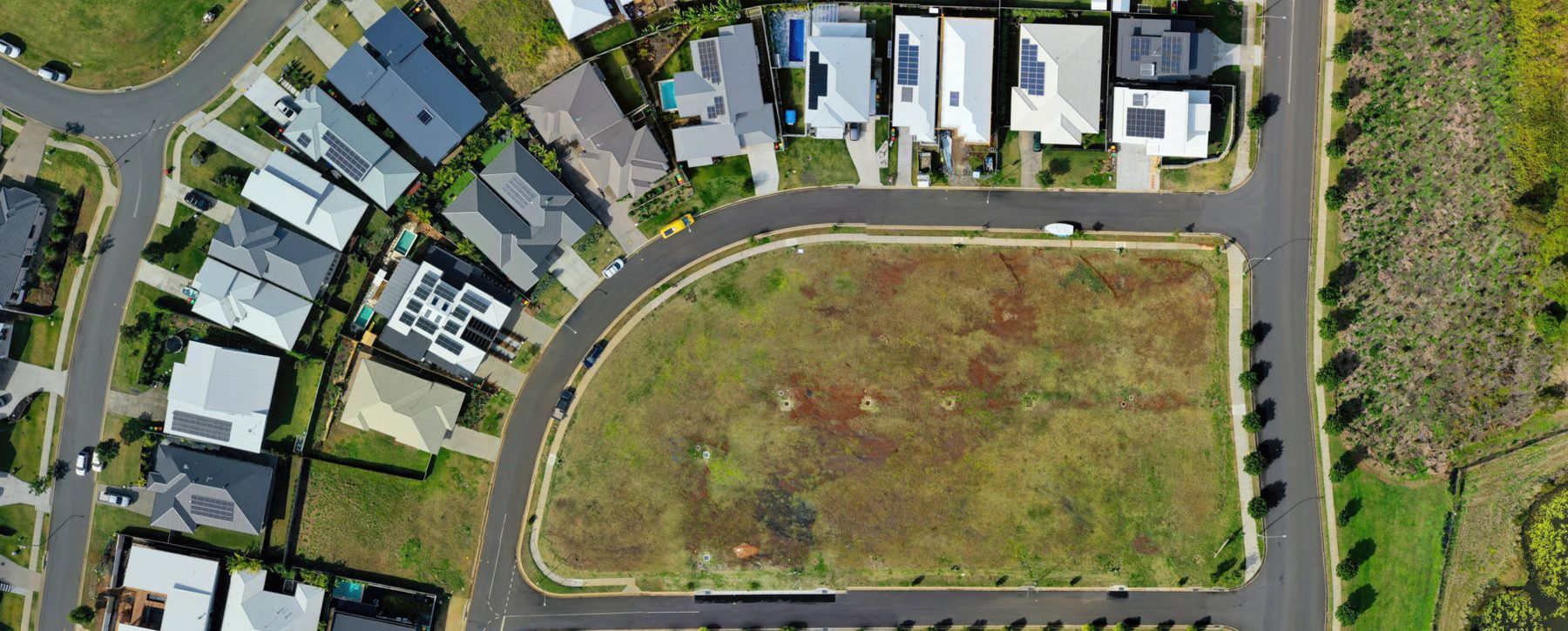
The shot your super can’t take from the ground. Dated progress imagery for clients, investors and marketing.
Gold Coast · Brisbane · Northern Rivers and beyond
Drone mapping, photogrammetry, 3D site models, progress aerials and inspection imagery for construction and property projects across the Gold Coast, South East Queensland and Northern Rivers.
Quick answer Kybos provides drone mapping and aerial capture, including progress aerials, orthomosaics, photogrammetry models, roof and facade inspection and thermal imaging. A CASA-licensed remote pilot flies them, with $20M public liability, across the Gold Coast, South East Queensland and the Northern Rivers. Airspace is checked before anything is quoted.
Last updated
The shot your super can’t take from the ground. Dated progress imagery for clients, investors and marketing.
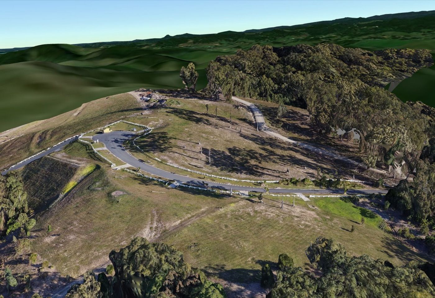
Capture the whole site as usable spatial data. Orthomosaics, photogrammetry models and geo-referenced aerial data for planning, documentation and project context, or browser-based photoreal 3D for visual communication.
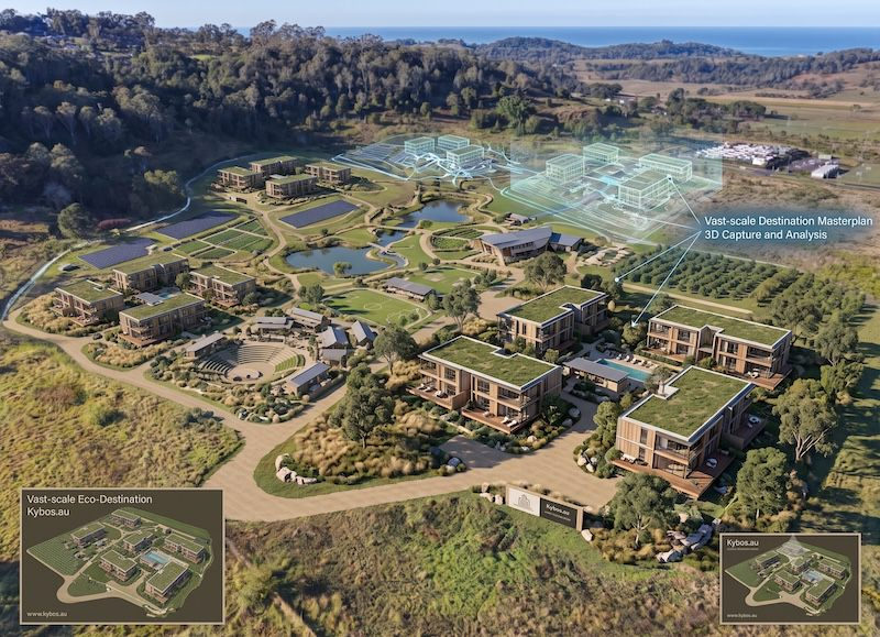
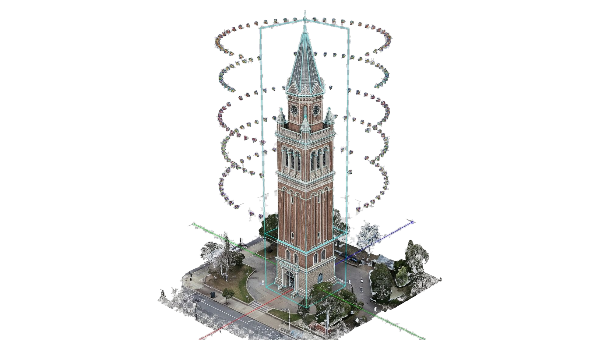
Fly to the coordinates. Record the parameters. Visualisation teams specify each camera position, height and bearing in advance; the capture parameters are recorded so the render can be matched into the photo in post.
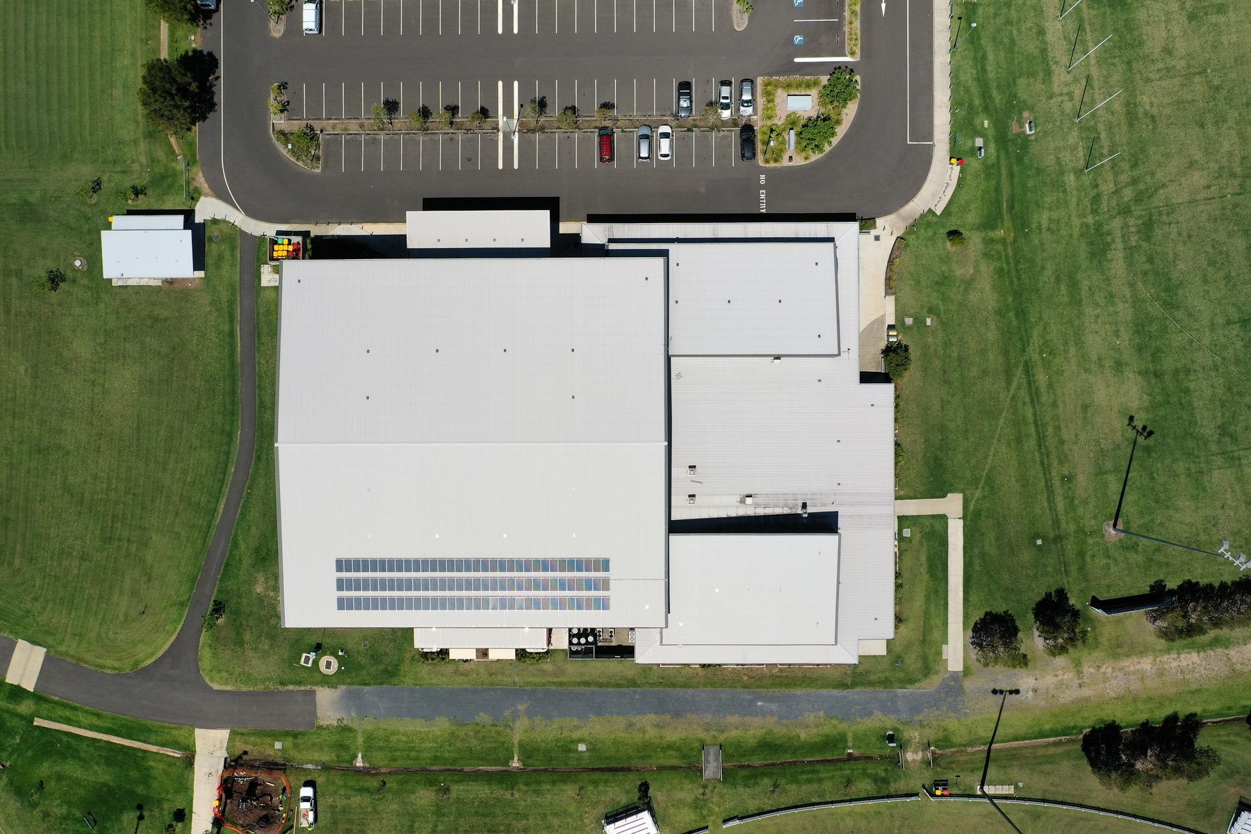
Nobody goes up on the roof. Close-range visual capture of roofs, facades and anything else that would otherwise need a scaffold, an EWP or someone on a harness.
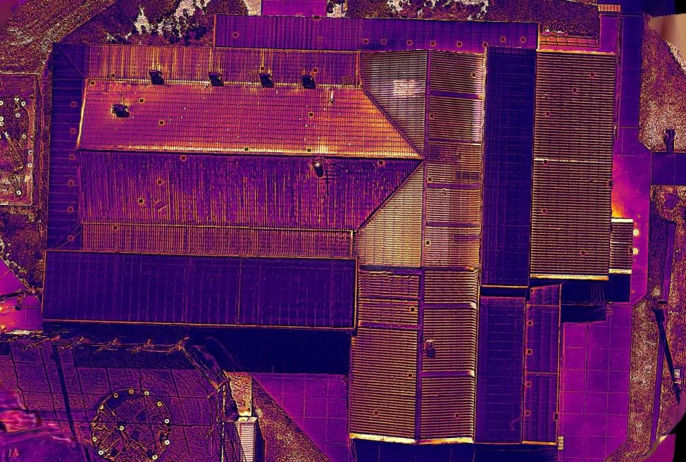
Find the problem before it becomes visible. Radiometric thermal imaging locates moisture ingress, insulation defects and overheating components that warrant closer investigation.
A 69-lot estate, from our drone capture. Pick an area or draw one, set the height and the overlap, and the flight lines, photos and time in the air follow. Then the drone flies the plan.
A planning sketch for a typical mapping drone, not a quote. Real flights are planned for the site, its airspace and CASA’s rules, which set a 120 m height limit.
Gaussian Splatting turns aerial imagery into a photoreal 3D environment you can orbit, explore and share in a browser. It complements traditional mapping outputs when visual context and easy remote viewing matter more than a conventional photogrammetry mesh.
Fly through one in Site Atlas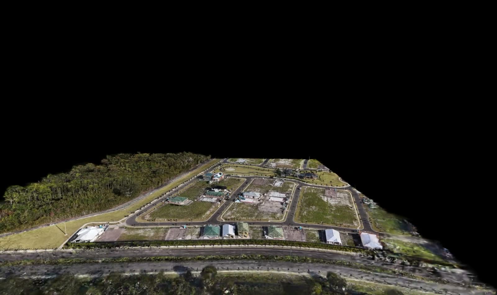
Temporary housing for residents affected by the 2022 floods, captured as an aerial 3D model.
Roof inspection from the air. Close-range imagery of the whole roof plane without anyone going up there.
Camera positions flown to specification for an upcoming development.
Not every site can be flown. Proximity to an aerodrome, controlled airspace, flight paths and people on the ground all change what’s possible, and some of it changes what’s legal.
Send the address. You’ll get a straight answer on whether it can be flown before anything gets quoted.
Yes. Kybos provides drone 3D mapping and aerial capture across the Gold Coast, South East Queensland and Northern Rivers. Outputs can include orthomosaic imagery, photogrammetry models, aerial 3D models, progress imagery and visual inspection records.
Drone capture provides site-wide context, progress documentation and coverage of roofs, façades, large footprints and other areas that are difficult to document from the ground. It can be delivered on its own or combined with terrestrial 3D capture.
Depending on the scope, deliverables can include orthomosaics, aerial imagery, photogrammetry models, 3D site models and geo-referenced data for documentation, planning and visualisation workflows.
Yes. Aerial capture can be combined with ground-based LiDAR or 3D scanning to document both the wider site and detailed building conditions within the same project workflow.
Yes. Operations are conducted by a CASA Remote Pilot Licence (RePL) holder with $20M public liability, subject to site and airspace requirements.
Airspace checked and a quote back the same day.
Get a quote