New: KYBOS Site Atlas. Your whole site as one interactive 3D map. Explore Site Atlas

Gold Coast · Brisbane · Northern Rivers · & beyond 3D scanning and digital capture for the construction industry.

Laser scanning and drone imagery for buildings, sites and infrastructure: a permanent record of every stage, from the slab before the pour to what’s behind finished walls.

01 · Existing conditions

Day one. The site as it stands.

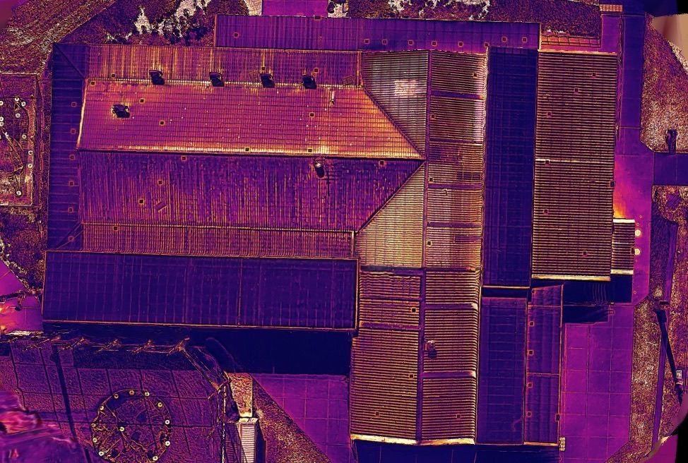
A dated 3D record of the site the day you arrive, for takeovers, insurers and design. It draws the line between their work and yours.

02 · Dilapidation

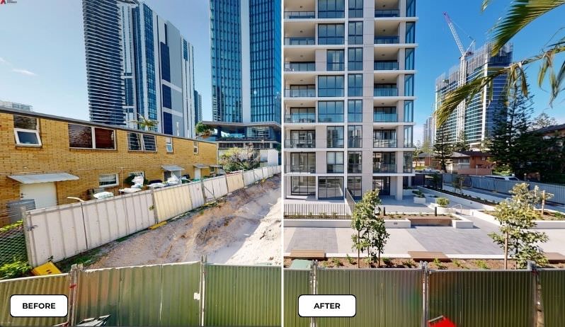
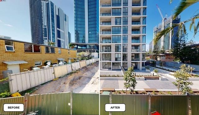
All adjacent properties. On record.

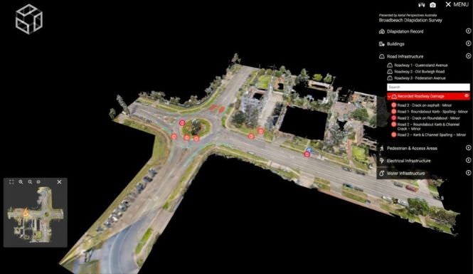
Fences, kerbs, driveways and facades in measurable 3D, dated before work begins. The dilapidation record can also be integrated into Site Atlas.

Construction Dossier

One lot. Every stage, kept forever.

A Construction Dossier captures each stage of one build and hands you an offline record that transfers with the property.

03 · Pre-slab

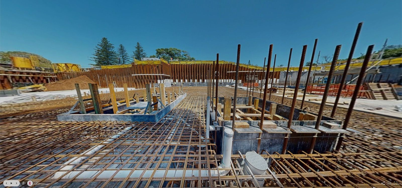
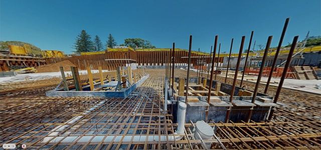
The slab. Before the pour.

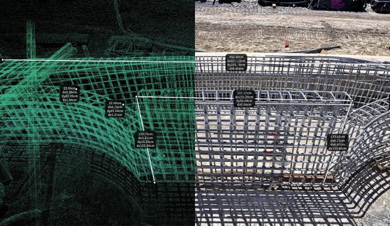
Set-out, penetrations and in-slab services, recorded while they can still be seen.

04 · Pre-plaster

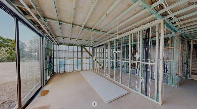
The frame. Before the sheeting.

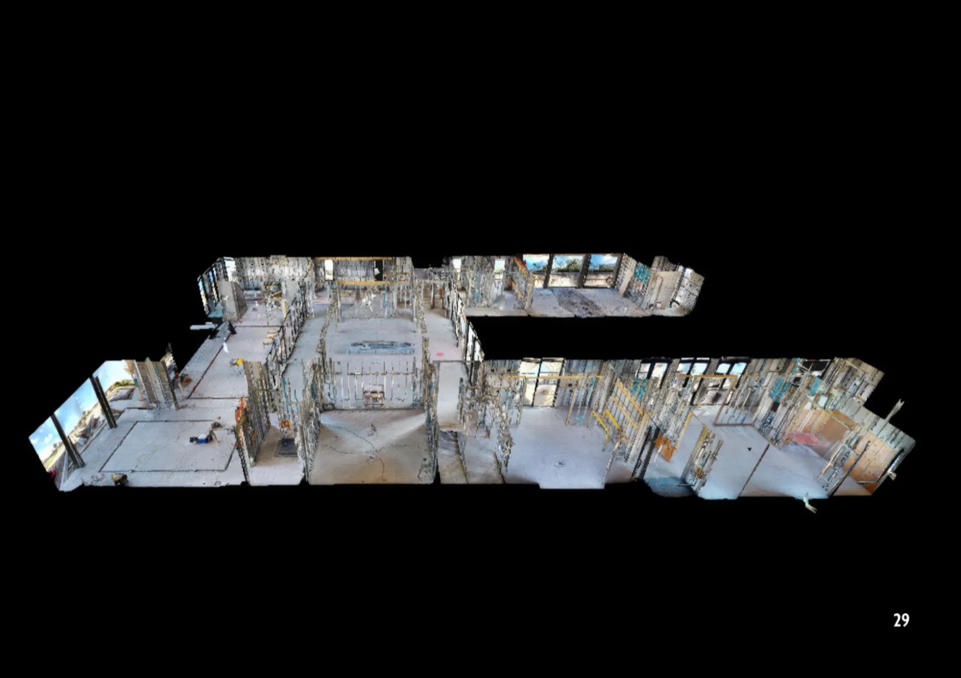
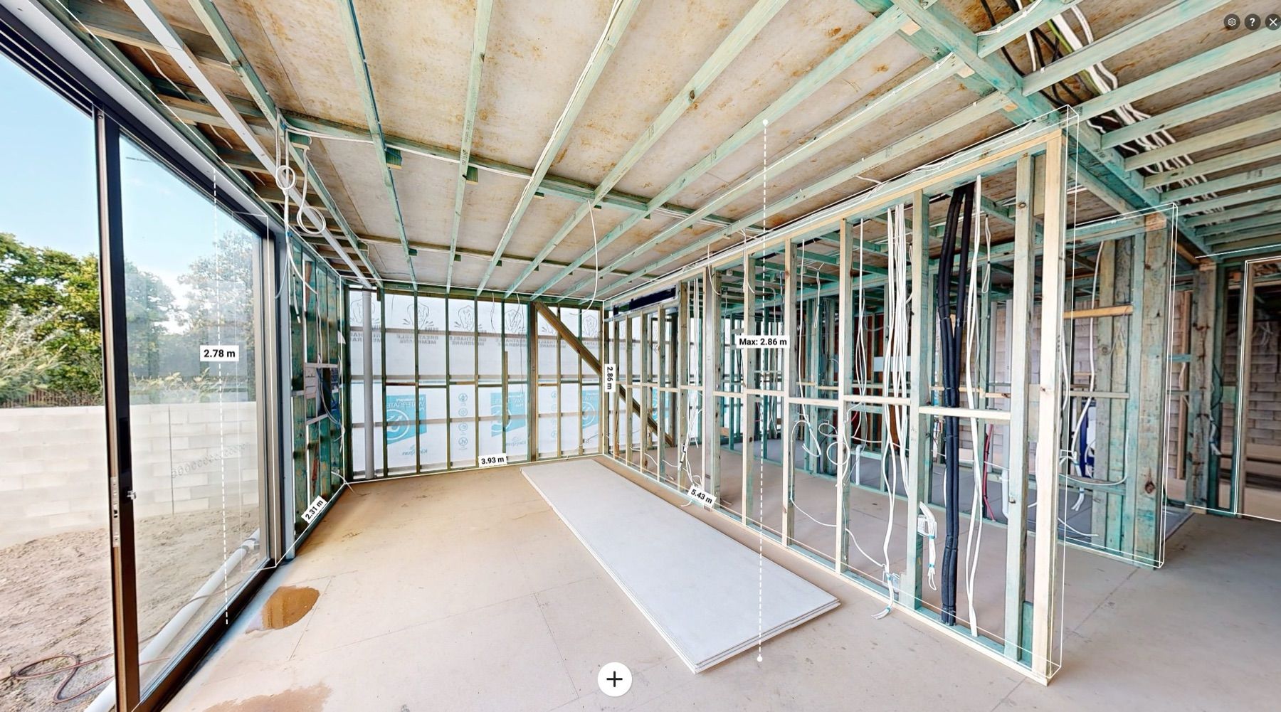
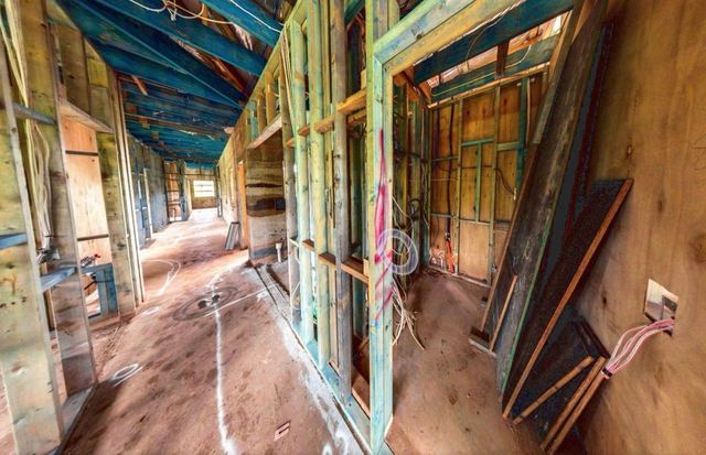
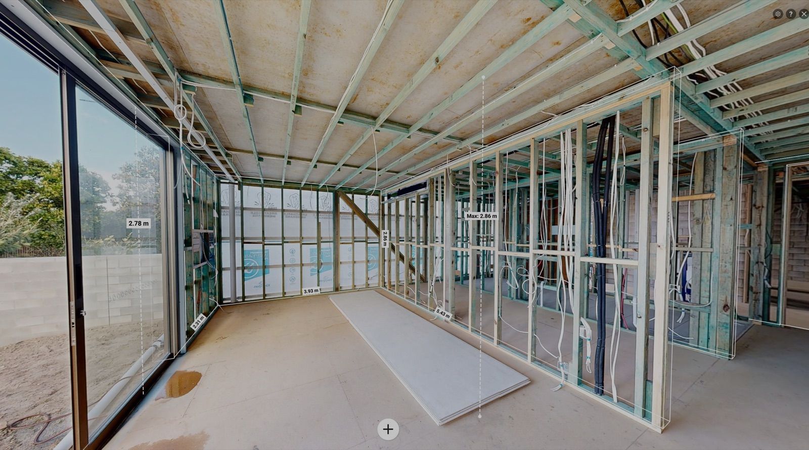
Framing, electrical, plumbing, HVAC and every trade’s rough-in, captured before the plasterboard goes on.

04 · Inside the walls

Every stud, pipe, cable and duct. On record.

When someone asks what is behind a wall, you open the capture and look.

Inside a pre-plaster 3D capture

Walk the home

Open the 3D capture

05 · Handover & defects

The walls close. The record doesn’t.

Condition at sign-off and documented defects, with everything behind the plaster still measurable.

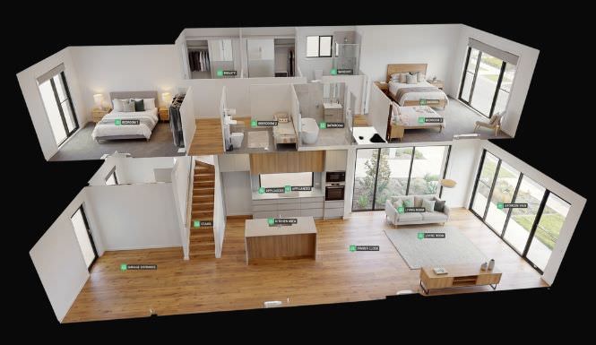
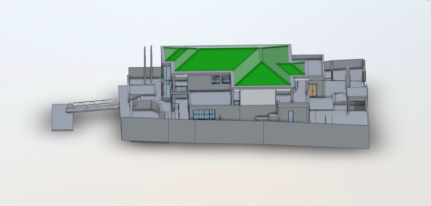
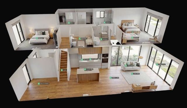
Cut-away 3D model of a home at practical completion

At practical completion

Final & defects capture

Site Atlas

Every lot. One link.

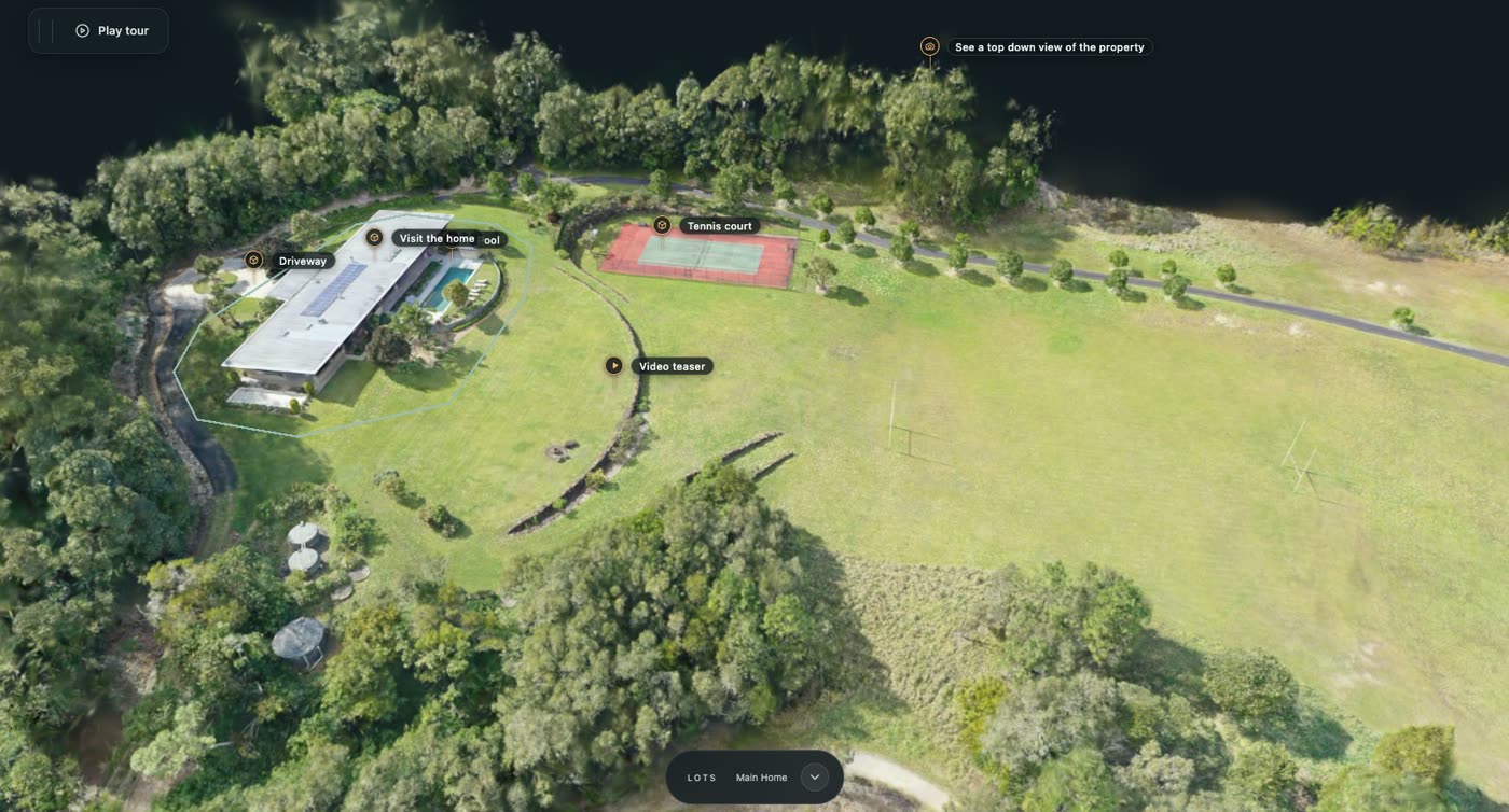
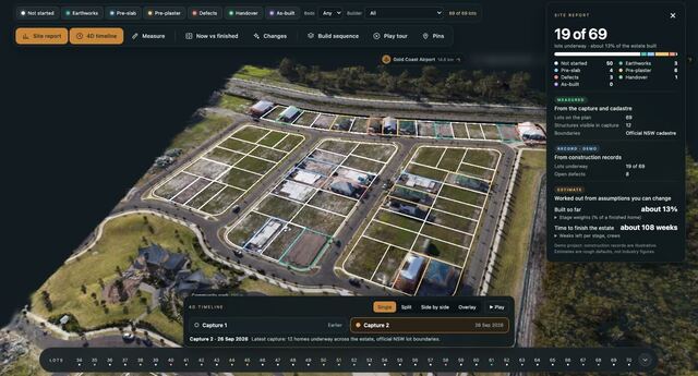
Site Atlas puts every lot, stage and capture of a development on one interactive 3D map, opened in any browser.

4+

Stages where the evidence disappears. Most projects use two.

  • Accuracy10–20 mm
  • On site1–4 hr
  • Delivery24–36 hr
  • Capturing since2018
01Construction 3D capture
02Three ways to work with us

From one stage to the whole estate.

Book a single capture when a stage carries risk, keep a whole build in a Construction Dossier, or put every lot of a development on one interactive 3D map.

Pre-plaster 3D capture of a framed home
01

For builders, trades & certifiers

Capture

One stage. One visit.

Existing conditions, dilapidation, pre-slab, pre-plaster or defects, captured in 1–4 hours on site and delivered in 24–36 hours as a measurable 3D record.

  • Existing conditions
  • Dilapidation
  • Pre-slab
  • Pre-plaster
  • Final & defects
Construction 3D capture
Cut-away 3D model of a finished home
02

For homeowners, builders & buyers

Construction Dossier

Every stage. Owned forever.

From the untouched site to handover, every stage of one build, delivered as an offline copy that transfers with the property. No subscription.

  • 5 stages
  • Offline copy
  • Transfers with the home
Construction Dossier
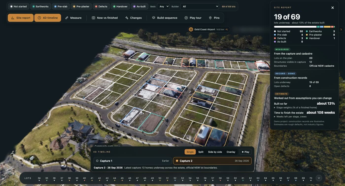
Site Atlas: an estate with each lot coloured by build stage
03

For developers, PMs & asset managers

Site Atlas

Every lot. One 3D map.

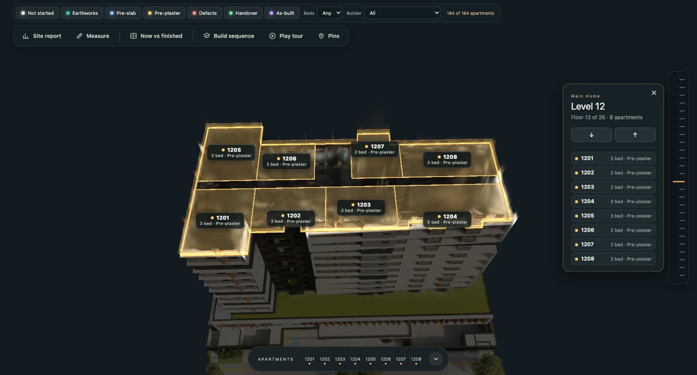
Estates, towers and portfolios as one interactive 3D map: lot status, build stages, plans and a 4D timeline, opened from one link.

  • Estates
  • High-rise
  • Real estate
  • Assets
Site Atlas
03Construction Dossier

Your build, documented forever.

You’ll spend a fortune on this build and remember almost none of it. Every stage tells a story that’s gone the moment the next one covers it.

A Construction Dossier captures each one, measured and kept, so whatever you need to know later, the answer is a click away, not a jackhammer.

  1. DilapidationBefore the work starts
  2. Pre-slabBefore the pour
  3. Pre-plasterBefore lining
  4. DefectsAt practical completion
  5. HandoverAt handover

Site pass · Lot 44

Every stage, one scan away.

Point your phone at the code on the passTap the code on the pass to walk through Lot 44 before the plaster went on.

Drag it, throw it, double-click to flip it.Swipe it, double-tap to flip it.

Most 3D captures are rented. A dossier is owned.

FeatureConstruction DossierHosted 3D capture
Access lastsPermanentlyWhile the subscription runs
Ongoing costsNoneAnnual fee
Transfers with the propertyYesUsually not
Survives the provider closingYesNo
  • Living in it

    Mounting a TV or chasing a leak: open the dossier, find the pipe, drill once.

  • Renovating it

    The next architect starts from reality, not exploratory demolition.

  • Selling it

    Proof of structure, waterproofing and services, where other sellers have a promise.

  • For the builder

    Dated evidence of what was installed, ready for a defect claim three years on.

04Site Atlas

Every lot. Every stage. One interactive 3D map.

Site Atlas turns a 3D capture of your site into a map anyone can open in a browser. Click a lot, a home or an apartment to see its listing, build stage, plans and photos. Capture it again and see what changed.

  • 4D timeline
  • Official lot boundaries
  • Photos, video & 3D tours
  • Plans filed by lot
  • Measure in metres
  • Tower levels
  • Private sharing
  • Enquiries to your inbox

Try it · 69-lot estate

The estate, on your table.

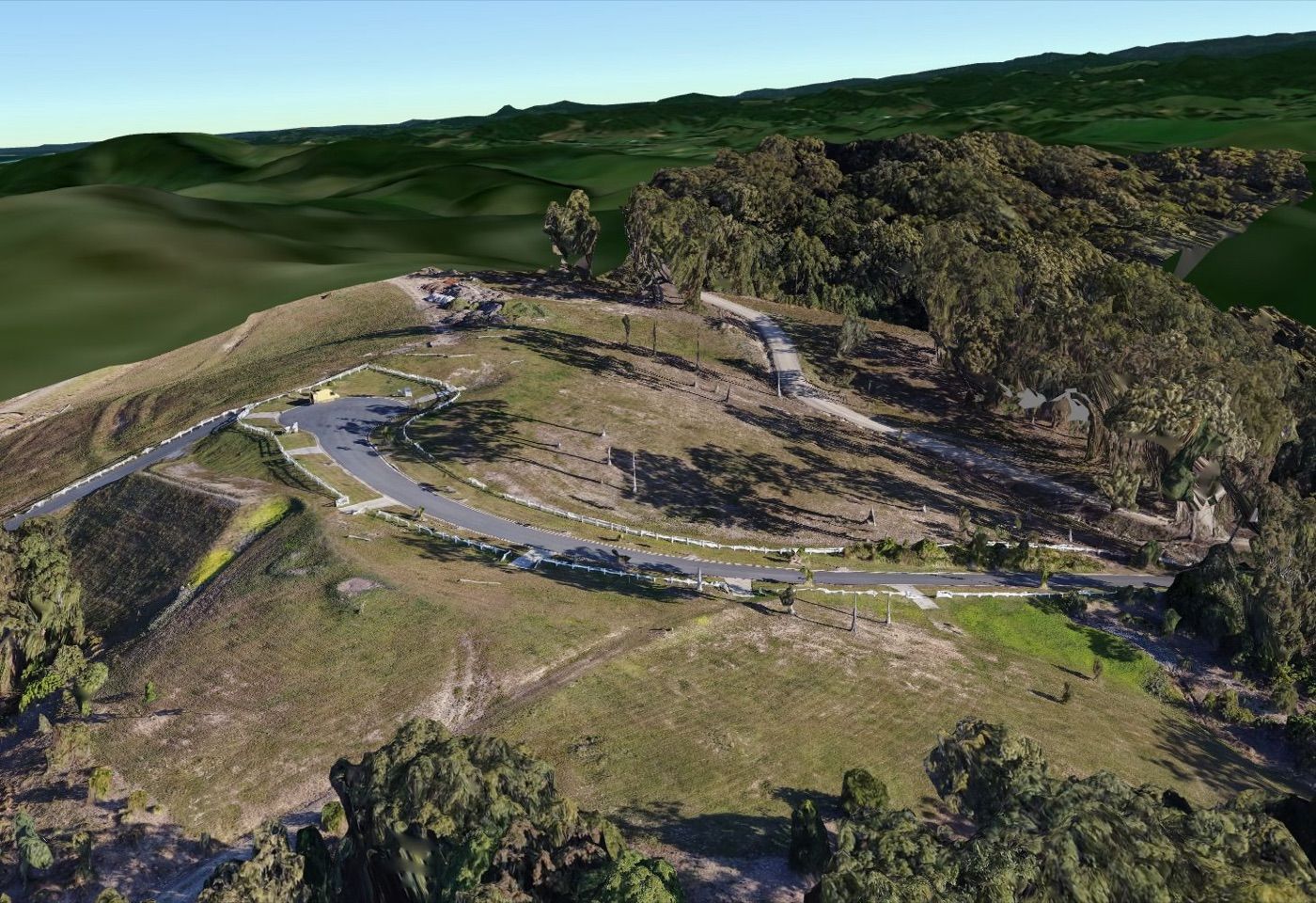
Our drone capture of a 69-lot estate, every lot on its official boundary and coloured by its build stage. Point at a lot to read it, click to fly to it, drag to turn the table.Tap a lot to fly to it, swipe sideways to turn the table.

  • Not started
  • Earthworks
  • Pre-slab
  • Pre-plaster
  • Defects
  • Handover
06Who it’s for

Different roles, different records.

We scope every project to the stages that carry the most risk, and nothing more.

Builders & trades

Catch issues before they cost you, and hand over a dossier your client keeps for life.

Best fit · Capture + Dossier

Developers & PMs

Every lot, stage and capture across the whole development, on one link.

Best fit · Site Atlas

Architects & engineers

Verify what was built against what you drew, and design from measured geometry.

Best fit · Point cloud + Scan-to-BIM

Homeowners & buyers

Know exactly what was built and how, for the biggest investment you will make.

Best fit · Construction Dossier

07See a 3D capture

Don’t take our word for it. Walk through one.

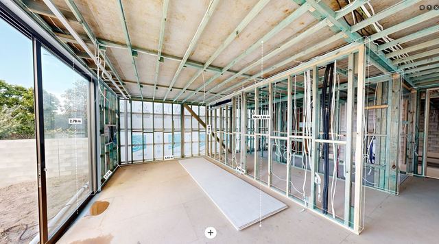
A pre-plaster capture from a live site. Move through it, take a measurement, open the floor plan. This is what lands in your inbox.

Pre-plaster 3D capture of a framed living room Open the 3D capture Pre-plaster · 3D walkthrough · No app, no login
  1. 01

    Request your quote

    Tell us about your project, its location and its construction stage.

  2. 02

    We capture your site

    Generally 1–4 hours on site, working around the trades. No shutdown, no exclusion zone.

  3. 03

    Receive your records

    24–36 hours later: an interactive online model and accurate documentation. Forward it to anyone.

Louis Pont on site with a laser scanner in a framed house
Louis Pont, founder. CASA-licensed remote pilot. Bachelor of Urban & Environmental Planning, Griffith University.
08Coverage
Operating across Australia and the South Pacific. Select a location to start an enquiry.

Ready to document your next project?

Quote back to you within 24 hours.

Get a quote

Gold Coast · Brisbane / SEQ · Northern Rivers · Sunshine Coast · Sydney & Melbourne by arrangement · Australia-wide for larger projects

09Questions

Plain answers.

01What does KYBOS do?

KYBOS is an Australian 3D scanning and reality-capture provider specialising in construction documentation, existing-conditions and dilapidation capture, point clouds, Scan-to-BIM and drone documentation. We also run Site Atlas, which puts a whole development on one interactive 3D map. Operating since 2018 and trading as KYBOS since 2026.

02What is a Construction Dossier?

A complete record of one build: each stage, from the untouched site to handover, captured in measurable 3D. You own it outright as an offline copy, delivered on a drive and by download. No licence, no expiry, no account required. Copy it, back it up, hand it on with the property.

03What is Site Atlas?

Site Atlas turns a 3D capture of a development into a map anyone can open in a browser. Every lot, home or apartment carries its own record: build stage, plans, photos and 3D tours. Capture the site again and the timeline shows what changed. It stays private until you choose to share it.

04How fast can I get my 3D capture results?

Turnaround depends on project size, capture method and deliverables. Priority construction capture can be available in as little as 12 hours for suitable projects, while standard documentation, point-cloud processing and Scan-to-BIM work may take longer. Time on site typically ranges from 1 to 4 hours.

05How accurate is KYBOS 3D capture?

General reality-capture documentation is typically within about 10–20 mm, while higher-precision point-cloud workflows can target about 5–10 mm where the project requires it. The method and tolerance are confirmed when we scope your project.

06Where does KYBOS operate?

We primarily service the Gold Coast, Brisbane, South East Queensland and the Northern Rivers of New South Wales. Projects in Sydney, Melbourne and elsewhere in Australia can be undertaken or coordinated by arrangement.

07What deliverables and file formats can you provide?

Depending on scope: browser-based 3D records, E57, RCP/RCS, LAS and XYZ point clouds, Revit and IFC Scan-to-BIM models, DWG or DXF drawings, floor plans, elevations, aerial imagery and orthomosaics.

08How much does 3D scanning cost?

Projects are quoted individually based on site size, complexity, capture requirements, accuracy and deliverables. Indicative pricing is on our pricing page, or request a tailored quote by email at info@kybos.au or on 0451 052 500.