
Special Offer: Realsee Galois P4 – US$2,000 Off, Now US$5,499


The Realsee Galois P4 is Realsee’s flagship tripod-mounted 3D LiDAR scanner, built for professionals who need a faster way to capture highly detailed spatial data and immersive imagery from the same visit. It combines sub-10mm measurement performance over its primary working range, a 100m LiDAR range, dense colourised point clouds and high-resolution 24K panoramic imagery in one integrated system.
For architects, builders, facility teams, property professionals and reality-capture operators, the attraction is straightforward: one capture workflow can feed point-cloud, CAD, floor-plan and visual-documentation workflows without needing separate devices for every output.

Current pricing in Australia
Kybos currently lists the Galois P4 from AU$9,499 including GST. For Australian buyers, purchasing directly from Realsee after a Kybos referral also gives you local onboarding and a direct point of contact for choosing the right package and getting the unit into a working capture workflow.
Special worldwide offer: US$2,000 off — US$7,499 to US$5,499
for Kybos-referred customers, with orders completed directly through Realsee, the Galois P4 Standard package is currently reduced by US$2,000, from US$7,499 to US$5,499. This is a special worldwide Realsee offer available through the referral link. The Premium package is also discounted from US$7,999 to US$5,999 and includes 300 Realsee credits, while the Standard package includes 50 credits.
The referral offer is not limited to Australia. Buyers can order directly through Realsee using the Kybos referral route, with international fulfilment handled through Realsee.


What makes the Galois P4 different?
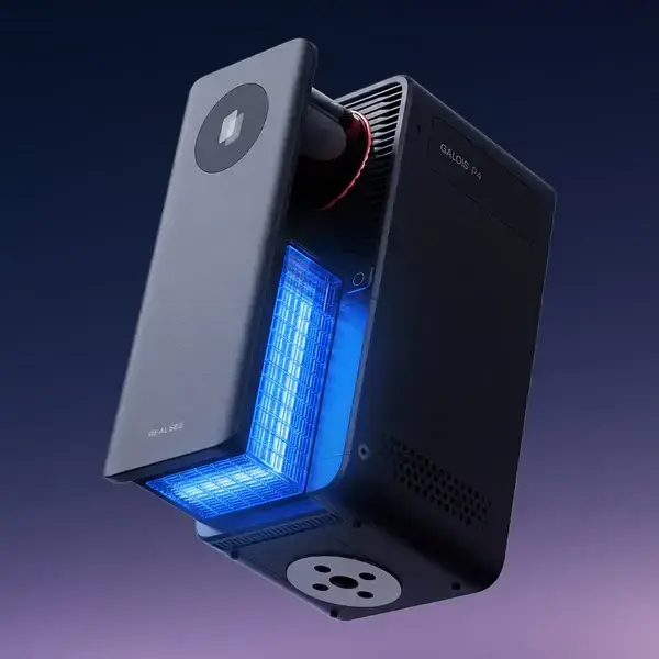
The P4 sits above the Galois M2 in the Realsee range. Where the M2 is a strong all-day 16K capture camera, the P4 is aimed at projects where denser point clouds, greater range and higher-resolution imagery matter more. Kybos’ current specification lists a 0.1–100m scanning range, ±10mm measurement error from 0.1–15m, a 125,600 points-per-second point rate and a 4/3-inch CMOS imaging system producing up to 300MP / 24K panoramas.
Fast capture from a single tripod position
Each scan position takes about 16 seconds, with automatic stitching handled through the Realsee platform. Kybos quotes approximately eight minutes per 100m² as a practical capture benchmark, although real project time still depends on layout, access, occlusions and how densely the space needs to be documented.
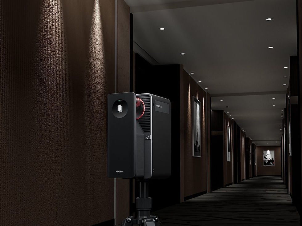
That speed matters on active projects. A scanner is most useful when it can be moved through a building without turning capture into the dominant site activity. The P4 is designed around that workflow: tripod position, capture, move, repeat.
One capture, multiple deliverables
The value of the P4 is not just the scanner itself, but what can be produced from the captured data. Depending on the workflow and processing selected, the same project can support:
Colourised E57 and PLY point-cloud exports for downstream CAD, BIM and analysis workflows
RAW imagery and high-resolution panoramic images
Browser-based, navigable 3D tours that can be shared without installing specialist viewer software
Measured floor plans and CAD outputs for documentation workflows
Source data for scan-to-BIM and existing-condition modelling

Where the P4 earns its keep
The P4 makes the most sense where the capture needs to remain useful after the site changes. Existing-condition records, as-built documentation, heritage interiors, facility documentation, high-end property capture and scan-to-BIM source data are all strong use cases.
For AEC work, its main advantage is the combination of spatial and visual information. A point cloud can support measurement and modelling, while the linked panoramic record provides context that a cloud by itself does not always communicate clearly to project teams.
Key specifications
LiDAR range: 0.1–100m at 90% reflectivity
Measurement error: ±10mm from 0.1–15m
Point rate: 125,600 points/second
Panorama output: up to 300MP / 24K
Camera sensor: 4/3-inch CMOS with 5-exposure HDR
Capture time: approximately 16 seconds per scan position
Battery: approximately 3 hours per battery, with two batteries included
Exports: E57, PLY point cloud, RAW images and navigable 3D tour

Is the Galois P4 a survey instrument?
The P4 is designed for high-detail spatial capture, but Kybos does not present it as a certified survey instrument and its output is not certified survey data. For projects requiring cadastral, legal or other certified survey information, the scanner should sit alongside the appropriate registered survey workflow rather than replace it.
A strong fit for professionals who need both data and context
The Galois P4 is compelling because it brings two usually separate requirements together: measurable spatial data and high-quality visual documentation. For teams that need to capture a building once and continue referring back to it for design, documentation, operations or presentation, that combination is often more useful than either a conventional photo set or a point cloud alone.
Kybos can help Australian buyers choose, onboard and deploy the P4, while the worldwide referral offer gives international buyers access to the same hardware at the current promotional Realsee price.


Comments